
Tri-Cities weather • Friday, May 5, 2023
Expect mostly cloudy skies throughout the day with off and on light rain showers. With the San Francisco low that drove our conditions most of the week having moved off toward the northeast, we no longer have warm moist air being pulled in from the south.
This takes away thunderstorm chances and gives us just some light and cool rain showers. Highs today around 60°F. Breezy conditions are forecast with the strongest gusts around 40 mph along I-84, including areas near Hermiston and Boardman. Elsewhere gusts to 30 mph are possible.
Trending warmer but remaining mostly cloudy with highs near 70°F for the weekend. With cloudiness remaining in the forecast, overnight lows are not expected to near freezing as the clouds act as a blanket by inhibiting heat from radiating out into space.
The next decent chance of rain showers in the Columbia Basin appears Monday with a cold front approaching the Pacific Northwest. The warming trend resumes Tuesday with highs possibly nearing 80° by the end of the week.
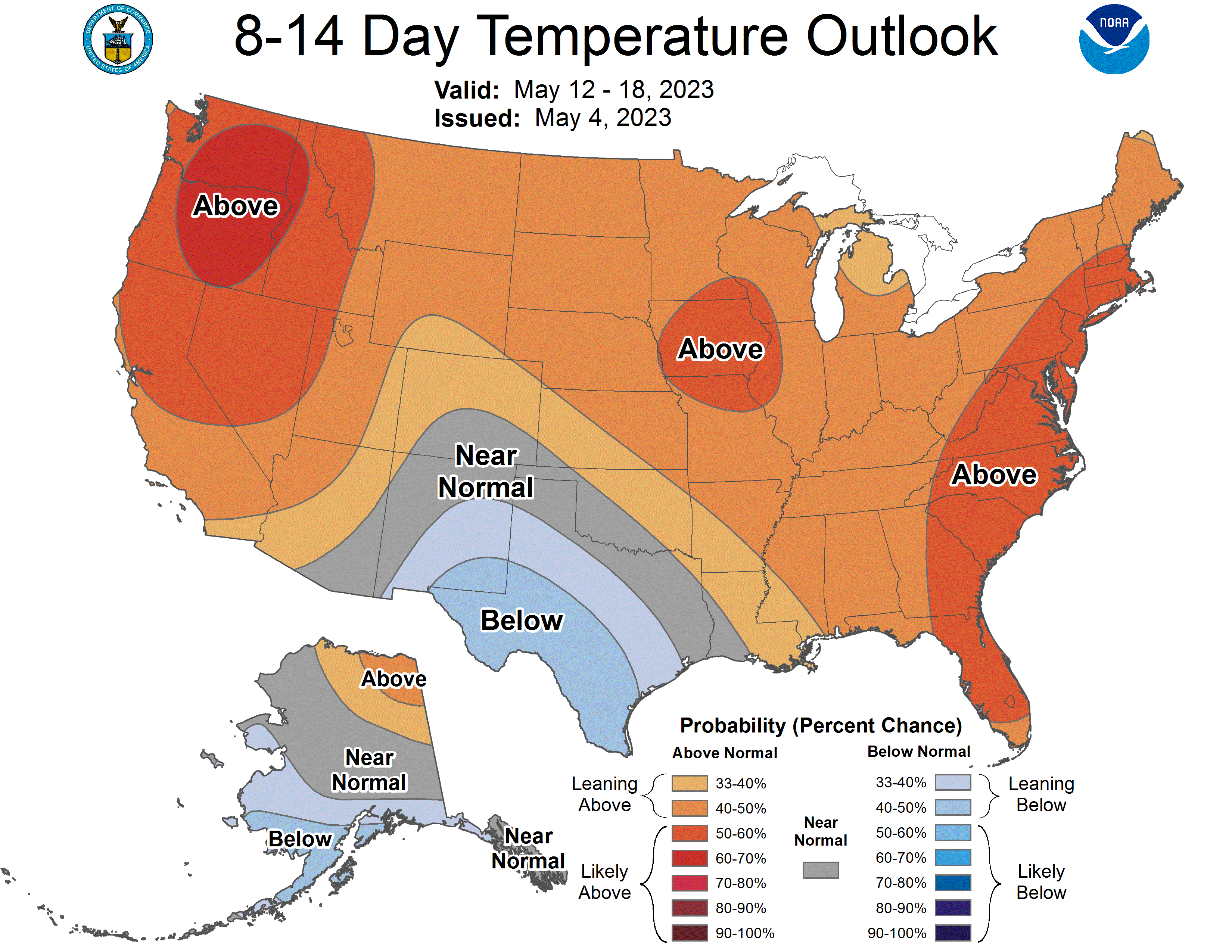
Weather models are showing a modest heat wave toward the second half of May. The Climate Prediction Center, a department of the National Weather Service, supports this idea in their forecasting but if you see temperatures near 100° around 10 days out in your weather app, take it with a grain of salt at this point.
If it does get warm, which is appearing likely, remember that river temperatures are not warm and that increased snowmelt will be causing rivers to run higher and faster than usual.


